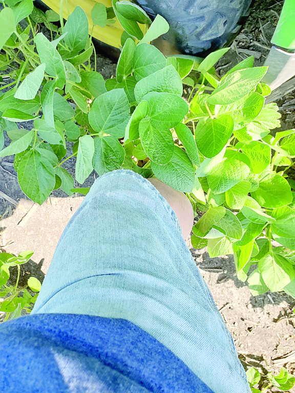
KNEE HIGH - The soybeans above were photographed on June 23 and were already knee high.
By MARK BERNARD
Staff Writer
What a ride the cropping season has been! We started with great optimism after a relatively easy winter aside from a brutal February. Temperatures well below normal were the main culprit and, like most of the winter prior to that, it was relatively dry. March arrived showing signs that it might be an early spring. It started us out with soils thawing and talk of small grain being seeded when conditions were fit. There were even rumors that, as a result of 63-degree high temperatures, someone had planted radishes in their garden on March 9th. (“Unrewarding” might be an apt description of the results, but I digress). Snowfall accumulations in mid-March tempered that optimism somewhat. The snow disappeared rather rapidly however, and by Easter Sunday there had been corn planted in the area. Temperatures cooled and we had some light precipitation the week following Easter. These cooler temperatures would come back to haunt later.
Some brave souls who decided to plant around Easter Sunday were questioning why no one else had planted in such perfect soil conditions. Calendar date is still a factor whether people like to admit it or not. Exposing the crop to additional risk planting much before the insurance replant date increases the odds it will end poorly. Insurance actuaries are nobody’s fools and is why they’re paid the kind of money they are. While it wasn’t the case in every ultra-early planted field, several of them were eventually replanted. Cold soils separated the men from the boys and some hybrids simply didn’t take it. Coupled with later than normal maturity hybrids being planted that are adapted to less hostile spring conditions farther south and one began to realize the envelope had been pushed about as far as it dared be pushed.
Soil conditions were very dry, however, and it was a struggle to plant the corn deep enough. It’s ingrained that early planting generally means a shallower planting depth in order to get the crop out of the ground more quickly. That backfired as some seed was in dry soil and came up more unevenly as a result. That’s been one of the hallmarks of this year’s corn crop in this area: Very few fields have perfect stands. There are gaps and unevenness in the stage of growth, in some cases up to two leaves. When this happens it usually means at best reduced ear size on those plants lagging behind and, in worst case scenarios, barren stalks. In other words, they’re basically a weed. Not that stands are poor, they’re adequate. They just aren’t as exceptional as some thought they’d be.
Corn was largely planted from around April 20th and wrapped up in about a week. A short rain delay followed, and soybeans were going in the ground the last couple days of the month into early May. After a couple warm days in early May, we were much colder than normal up until about the 20th. Warmer temperatures moved the crops along finally, so we could see what we had. A frost of sorts caught us off guard on May 29th and was cause for replanting on limited acres of soybeans. For the month, though, the GDU accumulation at the SROC was slightly above normal thanks to some of those warmer than normal days and warm overnight temperatures. Rainfall amounts varied widely by area, with some receiving near normal rainfall for the month and others far below normal. Despite the cold temps and dry weather, what was taking shape was a corn crop with some tremendous potential as we rolled into June.
June was a warm one. The SROC in Waseca finished the month 147 GDU’s ahead of normal and 1017 for the growing season from May 1. A lot of the corn planted will start to tassel once we’re over 1200 GDU’s. Soybean also moved along rapidly. Many of them as of July 4th were beginning to set pods. Cupped leaves were a main concern the last week of June. Many theories and potential explanations, but no solid evidence as to precisely what the cause is. Soybean aphids have been a no-show thus far. Beneficial insects enjoy warm dry weather too. June saw another month of variable precipitation. There were haves and have nots until late in the month. Some welcome rainfall came with many locations receiving 3” – 4” from June 26th – 28th. This set both crops up nicely to move into July, in particular the corn where adequate moisture for pollination can be crucial to attain optimum yields.
This is not to say the crop is in the bin, however. Far from it. What happens over the next 60 days will be crucial. While we are more fortunate than some, it’s unlikely there is enough soil moisture the rate this crop is using it to get us to the finish line with above average yields. The old rule of thumb was about an inch of rain per week once the corn tassels. Soybeans can rope a dope it until August and since the beans we plant are indeterminate; they can add flowers and pods later into the month. Throttling back the temperature a tad could help stretch that moisture supply in the meantime and perhaps buy us a little time. For some outside the growing area, they are less fortunate. Some lack the heavy clay loam soils and have missed out on the recent rainfall. For them, the sand is going through the hourglass at a more rapid pace. Here, we still need some help from Mother Nature here, but will we get it?
Crystal ball time. While June was generally gloom and doom, people’s attitudes changed once we got the rains late in the month. It took their minds off the dry conditions, so they could worry about something else. The forecast responsible for the last major rainfall event started out with some slight chances of rain farther out, but, as the week passed and got closer to those dates, the precipitation chances and predicted amounts increased significantly. The same pattern appears to be in store for this week with more predictions of some timely and plentiful rainfall. This was much the same pattern in place for much of last summer. It rained, dried out for 7 – 10 days, then wash, rinse and repeat.
Will the short-term tendency become a lasting trend? Perhaps, perhaps not. NOAA’s 6–10-day outlook is calling for better than even odds of below normal temperatures and better than even odds of above normal precipitation. Their 8–14-day outlook is opting for better than even odds of above normal temperatures while continuing to forecast better than even odds of above normal precipitation.
Some of the private weather pundits are calling for above normal precip for the month of July, particularly the last half of the month where others are calling for heat and drought to intensify for us over that same timeframe. Something about private forecasters is you can generally find a forecast that fits your mindset. When they’re right, they look like geniuses. They’re subject to the same parameters as NOAA and the NWS are. Right on time, then rely on them for the next event only to leave you disappointed.
Further out, NOAA’s July 30 day outlook is for better than average odds of above normal temperatures and better than even odds of below normal precipitation. Their 90-day prognostication (July through September) calls for better than even odds of above normal temperatures and even chances of above, below or normal precip. NOAA’s Seasonal Drought Outlook is calling for the drought to remain in place over southern MN, much of IA, the Dakota’s, the southern half of Wisconsin and lower Michigan. Stay tuned.